Putney to Richmond |
| Upstream: Richmond to Hampton Court | North: Barnes Bridge to Teddington | Downstream (North): Barnes Bridge to Embankment |
| Back to Main Page | Downstream (South): The London Eye to Putney |
Introduction
This walk parallels the route of the famous Oxford v Cambridge boat race from Putney to Chiswick, continuing on to Richmond where I stopped (after an abortive attempt to continue onto Teddington). The path passes the Wetlands Centre on the left passing under Hammersmith bridge into Barnes, then on to Kew, passing the famous Royal Botanical Gardens and Kew Palace on the left. Across the river there are views to Syon Park and Syon House. The Thames Path continues past The Old Deer Park to Richmond Lock and on into Richmond.
Getting to the Start
Putney has good transport links into central London and further afield. There are stations on the District Line Wimbledon Branch at Putney Bridge, across the river and East Putney. Putney Bridge & East Putney have frequent trains to Wimbledon, into central London and beyond towards Upminster. Putney Bridge and East Putney stations are both in London Travelcard zone 2.
Putney also has a rail station, which is at the top of the high street. From this station there are frequent trains (operated by South West Trains) to Wandsworth Town, Clapham Junction Queenstown Road, Vauxhall and London Waterloo. Putney also has frequent trains to Richmond, Twickenham, Hounslow, Staines, Windosr and Weybridge (and on Sundays also to Ascot, Bracknell and Reading).
The Walk
If you arrive at Putney Station as I did, turn right on exiting the station and head down the high street. As you get towards Putney Bridge cross the road and at the bridge turn left into Richmond Road. Keep right onto the Embankment to Putney Pier.
 |
 |
| Putney Bridge | Looking west from Putney Embankment |
Continue along Putney Embankment past the famous boat houses (where the annual Oxford and Cambridge boat race starts), where there is often a lot of activity. Across the river is Fulham Palace Gardens and Bishops Park, the church tower of All Saints Church, Fulham can also be seen. At the end of the road you cross Beverley Brook on a small footbridge. Along the river you can see Craven Cottage, the ground of Fulham Football Club.
 |
 |
| The path near Beverley Brook, with Fulham FC across the river | The path beyond Beverley Brook |
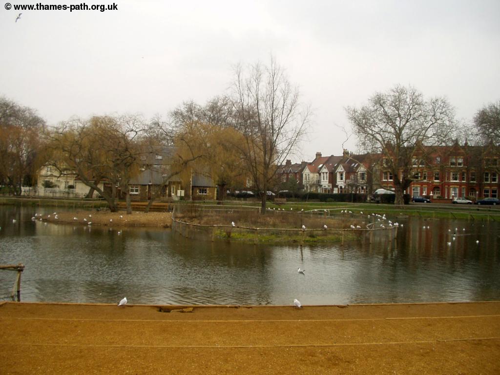
Beyond Beverley Brook the path takes on a far more rural feel. The tarmacked path of previous parts of the Thames Path give way to a tree-lined mud path. On the left you pass Barn Elms School Sports Centre and then another path goes off to the left, called Queen Elizabeth Walk. This takes you to the London Wetland Centre, a Wildfowl Nature Reserve, which was built on the former Barn Elms Reservoir. The centre opened in 2000 and was declared a Site of Special Scientific Interest (SSSI) in February 2002. The centre is open to the public daily, and the entrance is further down Queen Elizabeth Walk. Although The Thames path runs next to the centre you can't see much of it from the path.
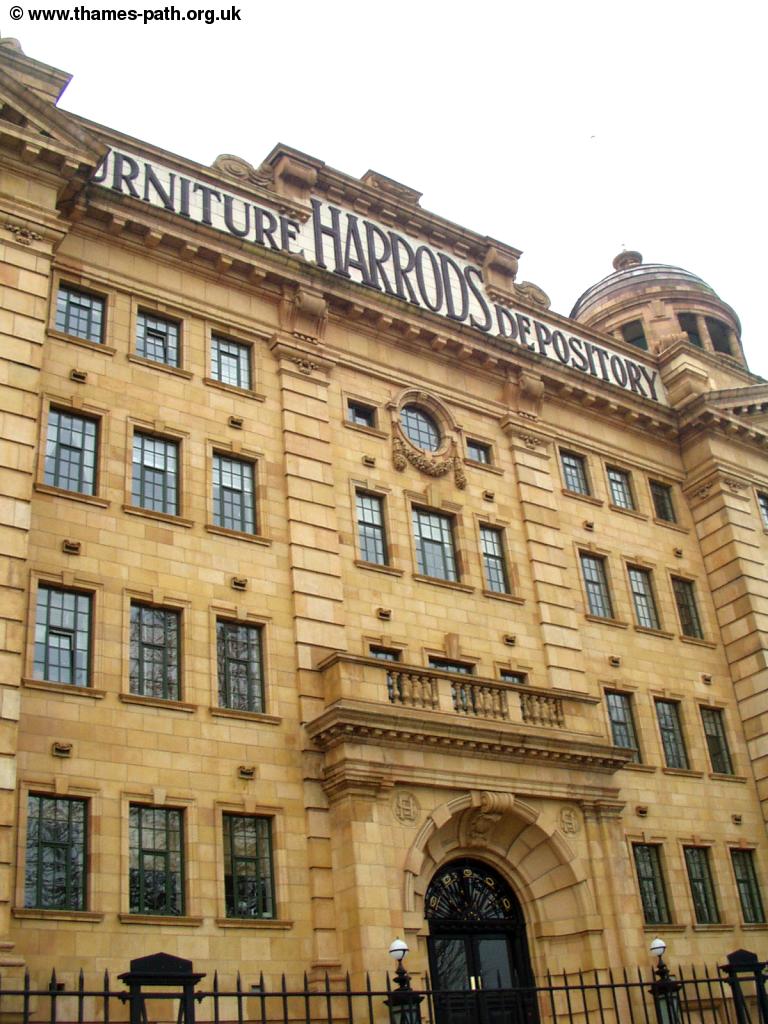
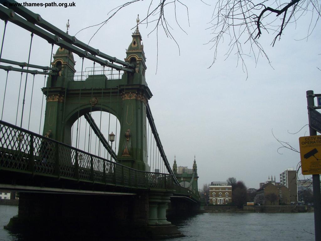
The walk next to the Wetland Centre is peaceful and soon you come to the former Harrods Furniture Depository, now re-developed into flats. The attractive Hammersmith Bridge is ahead.
 |
 |
| The former Harrods Furniture Depository | Hammersmith Bridge |
Hammersmith Bridge has a chequered history, three times being subject to bomb attacks. The first was in 1939, when an attempted IRA bombing was foiled. The bridge was again a target in 1996, when a large bomb was planted under the bridge, but failed to detonate. More recently, the bridge was again attacked in 2000, when a bomb exploded damaging one of the girders and was closed for a while for repairs, but is now fully open again. Pass under the bridge and you pass the building and sports grounds of St Paul's Boys School. The Thames curves round, past the oddly named Leg of Mutton Nature Reserve in a reservoir next to the path. Soon the path comes close to the road until it eventually joins the road, on a slightly raised path next to the river. When you come to a roundabout, The Thames Path continues straight on, under the bridge, however it's worth spending a few minutes to walk to the centre of Barnes. If you choose to, turn left and head up Barnes High Street where you get to the attractive village green, which still boasts a pond.
 |
| The pond in Barnes Green |
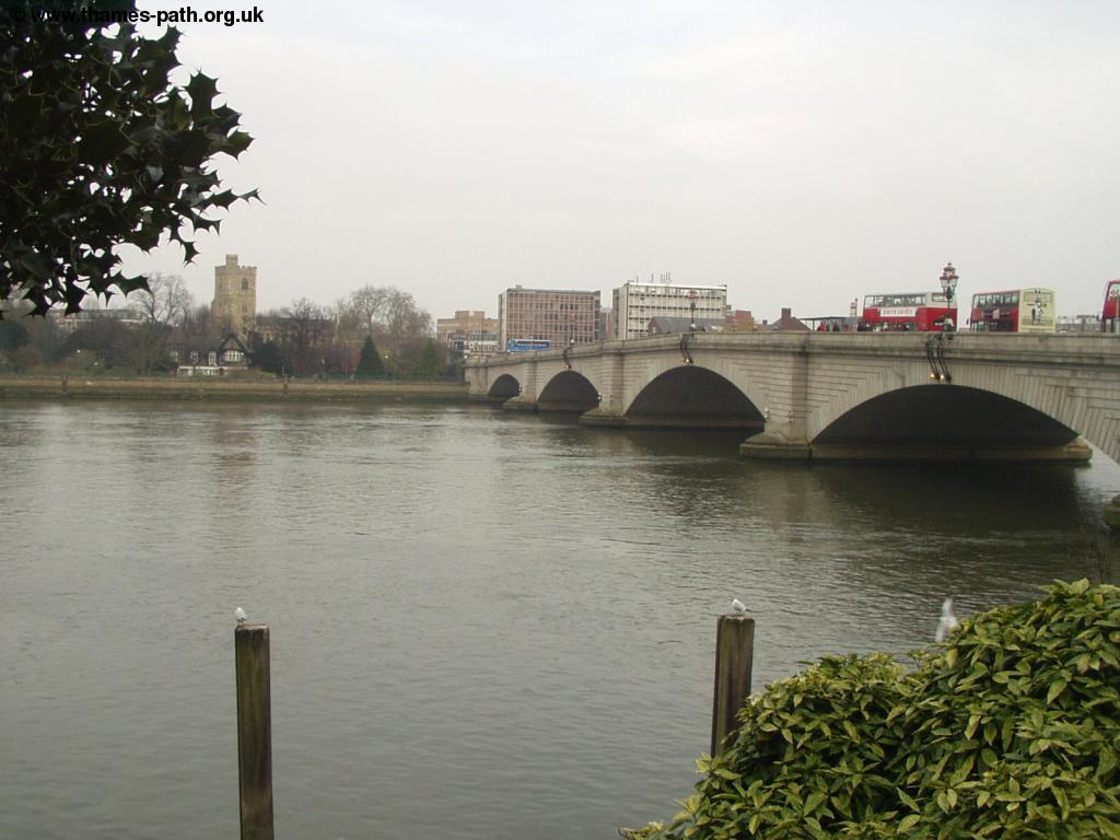
Back on the Thames Path, continue straight on under Barnes Bridge. Barnes Bridge station is at the top of the bridge and can be reached from the steps up onto the bridge from the other side of the road. The bridge carries the Hounslow railway line over the Thames, but there is also a footpath across the bridge too. An ugly bridge in my opinion, but it is now a Grade II listed structure. It has been neglected by British Rail and later Railtrack and is now listed on the English Heritage Buildings at Risk register, due to the poor condition of the ironwork.
 |
 |
| Barnes Bridge | Barnes Bridge, with boats |
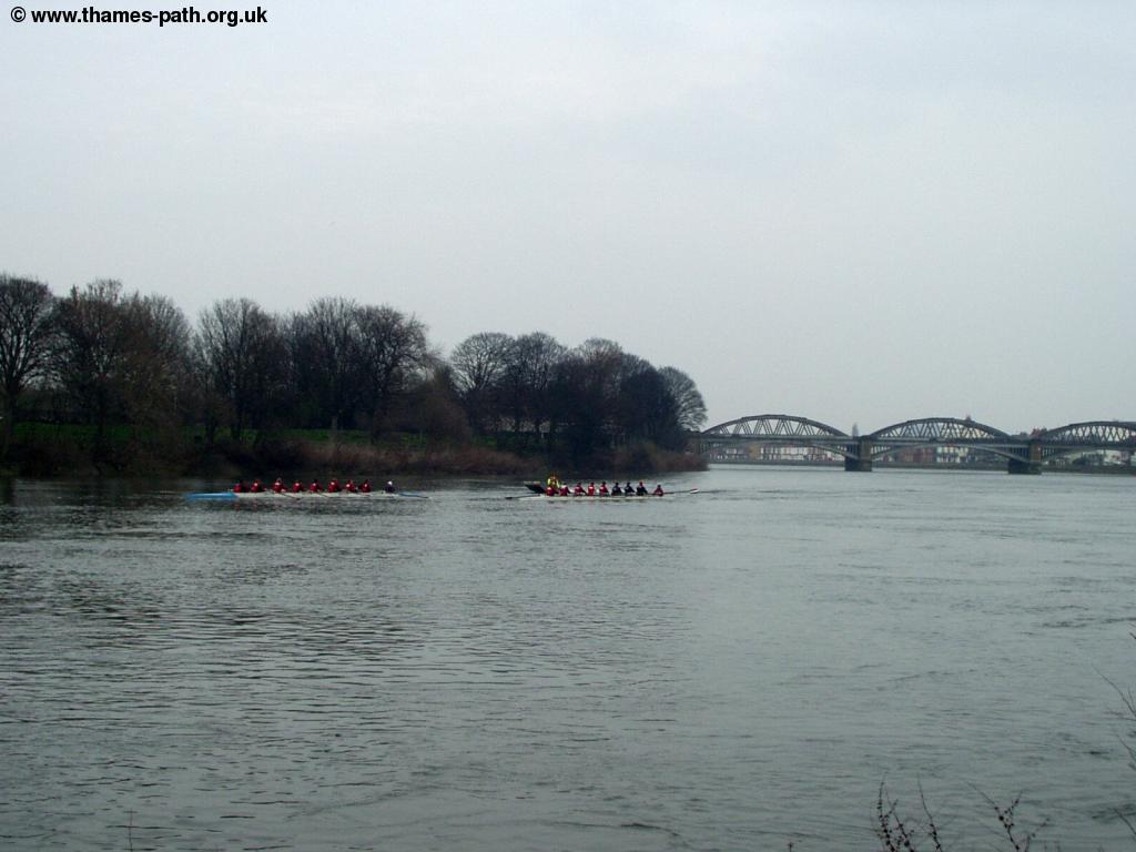
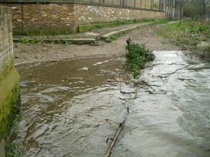
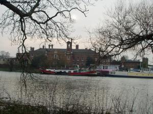
All along this section of the river you'll probably find a lot of rowing boats passing, with the crews often being given words of encouragement from a man with a megaphone in a motorboat. Once under the bridge the road heads away from the path once more and some industrial buildings line the riverside again. You could get wet feet just up from here though - I found the path partly flooded and as I didn't fancy getting wet feet, I had to head back to get onto the road (Mortlake High Street) for a bit, returning to the path down Ship Lane.
 |
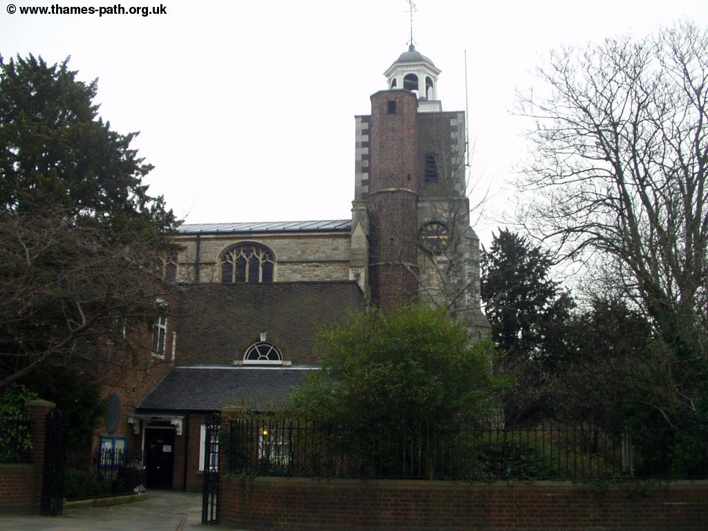 |
| I don't fancy crossing this, so time to head inland | A church on Mortlake High Street |
I rejoined the path by The Ship Inn, a riverside pub just by Chiswick Bridge, where a sign on the fence by the river warns that the road floods. There is a very wide (and rather grand looking) path under Chiswick Bridge and once under the bridge there is Hammersmith Cemetery on the left.
 |
| Chiswick Bridge |
After the cemetery, the map shows the path as running adjacent to a Sewage Works and Civic Amenity site, but fortunately that appears to have been demolished and luxury flats are now being built on the site. Soon you cross under the small Kew rail bridge and then past Kew Pier to Kew Bridge, with the entrance to Kew Gardens on the left and the village of Strand on the Green across the river.
 |
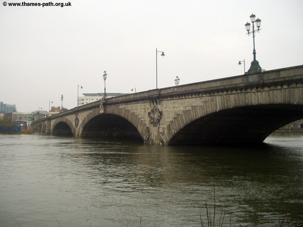 |
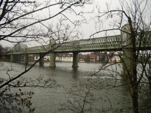
| Kew Rail Bridge | Kew Bridge |
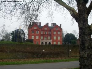
For the next mile or two you'll be walking next to Kew Gardens. The path initially starts at a high-level next to the road leading to the car park and you pass Kew Palace on the left. Kew Palace dates from 1631 and is another Royal Palace, used by the Royal Family from 1729 - 1818. The palace is currently closed to visitors, as repairs are being carried out. Kew Gardens are open to the public daily and were declared a World Heritage Site in 2003. The Thames path is separated from the gardens by a small stream (which probably helps to stop people getting in without paying too), but you do get good views of the gardens.
 |
| Kew Palace |
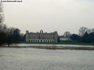
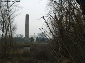
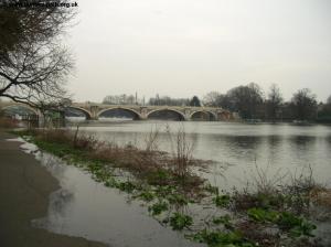
Soon the river gets very wide and the start of the Grand Union Canal can be seen across the river. As you continue next to Kew Gardens you also get excellent views of Syon House and Syon Park across the river. The house is the home of the Duke of Northumberland and is open during the summer, but only three days a week at present. On the left Kew Gardens soon gives way to The Old Deer Park, which also has a golf course. As I continued along this section of the path the river was becoming gradually higher until it began to slowly flood the path. Soon you also get views of Kew Observatory to the left.
 |
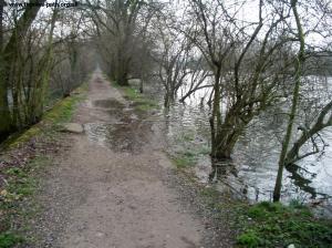 |
| Syon House and Park | The river gets a bit too close |
 |
|
| Kew Observatory |
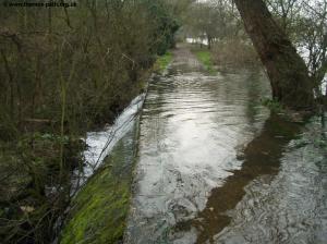
Not long later I come to a bit of the path that is even more flooded. Now the Thames is pouring over the path, forming a waterfall as it flows into the stream on the other side of the path. It's interesting to see how the river is rising too, I can watch more of the path slowly flood until almost the whole path that is visible behind has flooded. Oddly there hasn't been much rain in the last few days and the path doesn't show much evidence of recent flooding.
 |
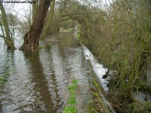 |
| The Thames pours over the path - I'm going to have to get wet to cross this.... | ... and looking back most of the path is now submerged |
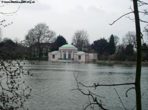
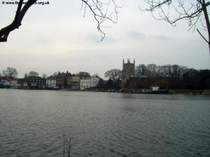
Across the river there is an attractive pink building (perhaps a summerhouse or conservatory) and you also get views to the attractive waterfront of Old Isleworth ahead. The church tower here dates from the 14th Century, but a more modern church building has been attached to the tower after the church was gutted by an arson attack in 1943.
 |
 |
| ?? | Old Isleworth |
I pass several more places where the Thames is flooding the path and flowing over the side where I again get wet feet. Over the river is the rather grand Gordon House, part of the Brunel University. Soon Richmond Footbridge can be seen ahead, next to Richmond Lock.
 |
 |
| Gordon House | Richmond Lock and foot bridge |
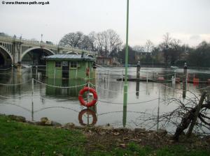
You pass Richmond Lock on the right and head under the bridge, with the Old Deer Park still to the right. Soon you come to Twickenham Bridge, followed almost immediately by a railway bridge, both of which you pass under where you come to Old Palace Lane. This road was now flooding quite badly, it was amusing to see geese swimming past a bench by the side of the river. I decided to try and walk past this bit, as it was badly flooded.
 |
 |
| Flooded Richmond Lock | More flooding by Twickenham Railway bridge |
 |
|
| More flooding |
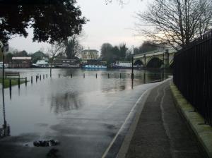
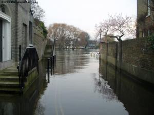
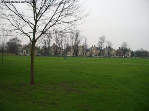
Trying to avoid the flooding takes me into the centre of Richmond, an attractive town, still with a large village green and many large and attractive houses around it.
 |
 |
| Richmond | Richmond Green |
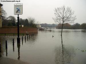
I headed down Friars Lane back towards the river, but again found the river had flooded the end of the street, and the path itself was now under a lot of water and so I decided to call it a day and head home.
 |
| The path underwater - time to give up I think |
Getting Back
Richmond Station has excellent transport links. To get to the station walk up Water Lane from the Thames Path, continuing straight ahead into George Street and continue straight on into The Square, where you head slightly left into The Quad. Richmond station is a short distance up this road to the right. Richmond station is something of a transport hub with regular rail links to most parts of London. South West Trains run regular trains to Clapham Junction & London Waterloo (most stopping at Putney on the way). Trains also run regularly (generally at least twice per hour) from Richmond to Twickenham, Staines, Windsor, Bracknell, Wokingham and Reading.
The London Underground District Line also runs to Richmond (the last station on the line), with frequent trains into central London, east London and on to Upminster in Essex. Richmond is in London Travelcard zone 4.
Finally, the Silverlink Trains North London Line starts at Richmond and heads across north and west London to Woolwich and Stratford in east London, with trains running every 15 minutes from Richmond (every 30 minutes on Sundays).
Links
The following web sites provide information on the area.
Every effort is made to ensure the accuracy of information on this site, but liability will not be assumed in the event of any inaccuracies. Use of the information on this site is at your own risk. If you find any errors, please use the link below. The text and photographs on this web site are all Copyright © and may not be reproduced without prior permission