Island Gardens to Embankment

Island Gardens to Embankment | |
| Upstream (North): Barnes to Embankment | Back to Main Page | Downstream: The Thames Barrier to Greenwich |
| Upstream (South): The London Eye to Putney | South: Greenwich to The London Eye |
Introduction
This walk takes in the Thames Path on the north bank of the Thames as it starts at Island Gardens, just accross the river from Greenwich. From Island Gardens the path heads west around the Isle of Dogs and then round the modern Docklands area, giving views of the many sky-scrapers that now exist there. Continuing west the path passes Limehouse Basin and the Regents Canal continuing through historic Wapping and St Katherine's Dock under Tower Bridge and into central London, following the embankment west to Embankment Station.
Getting to the Start
Island Gardens is accross the Thames from Greenwich. Parking your car is difficult, so public transport is strongly recommended (see below for details). If you do decide to drive, Island Gardens is just off the A1206 at the south of the Isle of Dogs. The A1206 is easily accessed from the A13 and A102 (Blackwall Tunnel) from the north or south banks. Parking in the area is very limited, with only on-street parking available. Currently on-street parking is restricted on weekdays, with pay-and-display available in certain marked bays with a maximum stay of 4 hours in the area - unlikely to be enough time to complete the walk and get back unless you walk quickly. Parking is also very expensive on weekdays. At weekends (at the present time) the on-street restrictions do not apply so you can park in bays for no charge and without time restriction, but check the notices in case the restrictions have changed. On weekdays it would be better to park in an off-street car park. There aren't any in the vicinity of Island Gardens, but there is a large car park (500 spaces) at Docklands (City Harbour) and a couple of car parks at St Katherine's Docks, both a outside the Congestion Charging zone and a short distance from this walk and with good public transport to Island Gardens.
By public transport, the Docklands Light Railway has a station at Island Gardens where this walk starts. Trains run frequently from Bank to Island Gardens and on to Greenwich and Lewisham. There are also connecting trains from Tower Gateway (adjacent to Tower Hill Underground station), where you can change at Limehouse for a Lewisham train and at Stratford where you can change to a Lewisham train at Canary Wharf. The Docklands Light Railway (DLR) has good connections with the London Underground at Tower Gateway (for Tower Hill), Bank, Stratford, Shadwell, Canary Wharf, Canning Town and Bow Church and connections with overground train services at Limehouse, Stratford, Canning Town, Custom House, Greenwich and Lewisham. Trains on the DLR run seven days a week.
The Walk
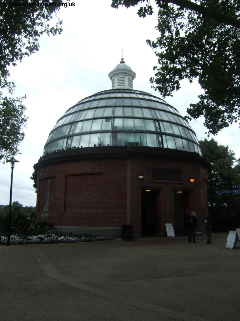
Island Gardens is a garden at the southern tip of the Isle of Dogs, opposite Greenwich on the south bank. A pedestrian foot tunnel passes under the Thames here, with it's attractive domed entrance. There is a small cafe in the park too, if you are in need of refreshment.
 |
 |
| The Greenwich Foot Tunnel | Greenwich from Island Gardens |
 |
|
| Island Gardens |
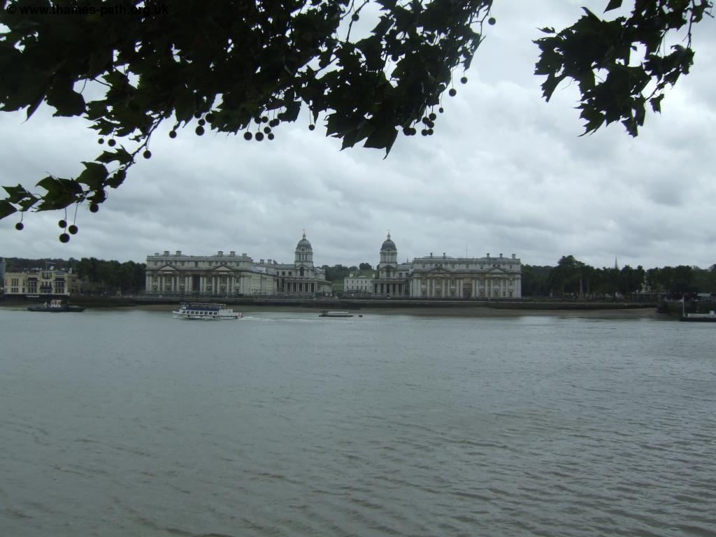
From the park you have to walk by the road for a short distance. From the foot tunnel turn left and continue on the quiet road which soon turns right to join the main road, which you follow for around a quarter of a mile before turning left and back to the waters edge. You can Deptford Creek on the opposite bank of the river.
 |
| The Thames and Deptford Creek |
Soon you have to turn right and leave the riverside again to briefly join the road before turning left back to the river - look for the numerous Thames Path signs directing you back to the river. Here you come to Burrell's Wharf, an odd mixture of old and new with the modern apartments round a square with an old chimney and another building with it's small tower making it look like it was once some sort of religious building.
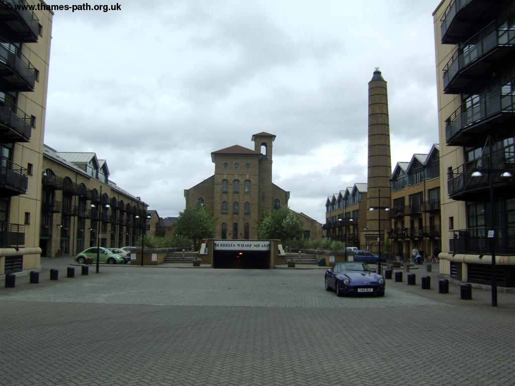 |
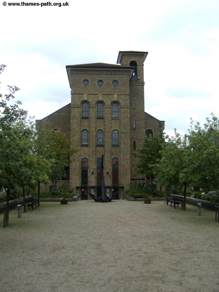 |
| Burrell's Wharf | Burrell's Wharf |
You can continue on the riverside path once more here before you again have to head away from the river to follow the main road, passing an interesting mix of buildings, including an old building on the right with numerous columns, known as the Space Arts Centre.
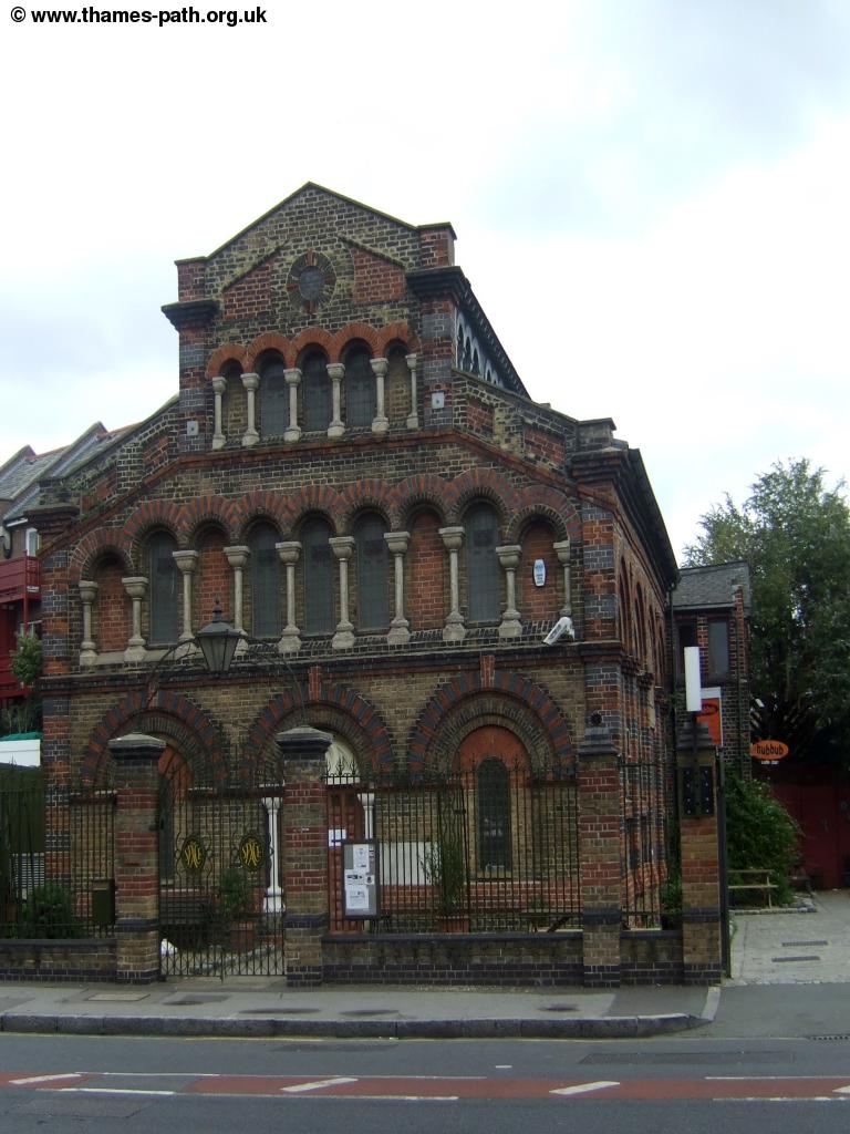 |
| Space Arts Centre |
Continue on the road a little longer, although you can take the path off to the left through a modern apartment block where there is a promenade along the river, sadly not joined at either end though, so you'd need to take the same route back to the road.
 |
| Modern Apartments |
Soon on your right you pass the large Millwall Docks on the right. This impressive stretch of water is almost half a mile wide and here you'll find some of the old cranes for loading boats and the Docklands Sailing Club.
 |
 |
| Millwall Docks | Millwall Docks |
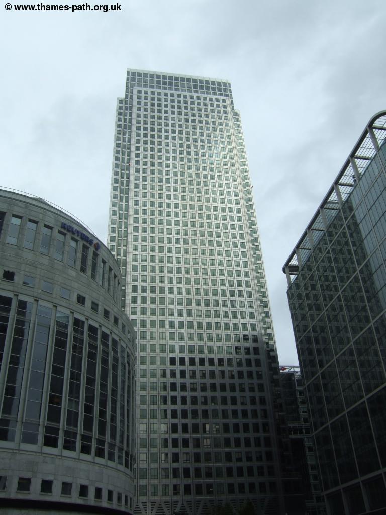
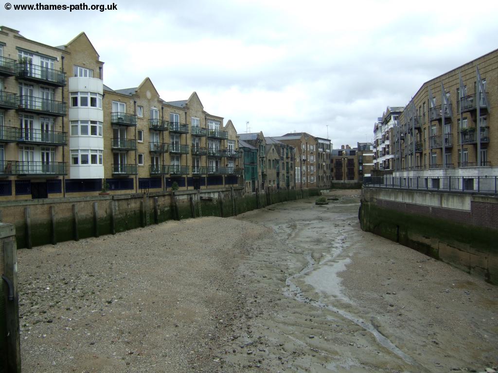
Continue on the main road for a while longer, passing gardens on the left and on past some unusual modern apartments, where the pent house overhangs the rest of the building! Continue along the road until you are signed left to rejoin the river to the creek leading into West India Docks, the heart of the re-generated Docklands, although it is perhaps a suprise that this creek looks rather run-down and unloved considering the amount of development going on in the area. Now perhaps more suprisingly, considering the land values in the area, you now pass an area of wasteland that appears to be a disused car park, no doubt this will soon be redeveloped, but it seems a strange contrast to the modern gleaming skyscrpaers beyond.
 |
 |
| Docklands Apartments | Rundown creek |
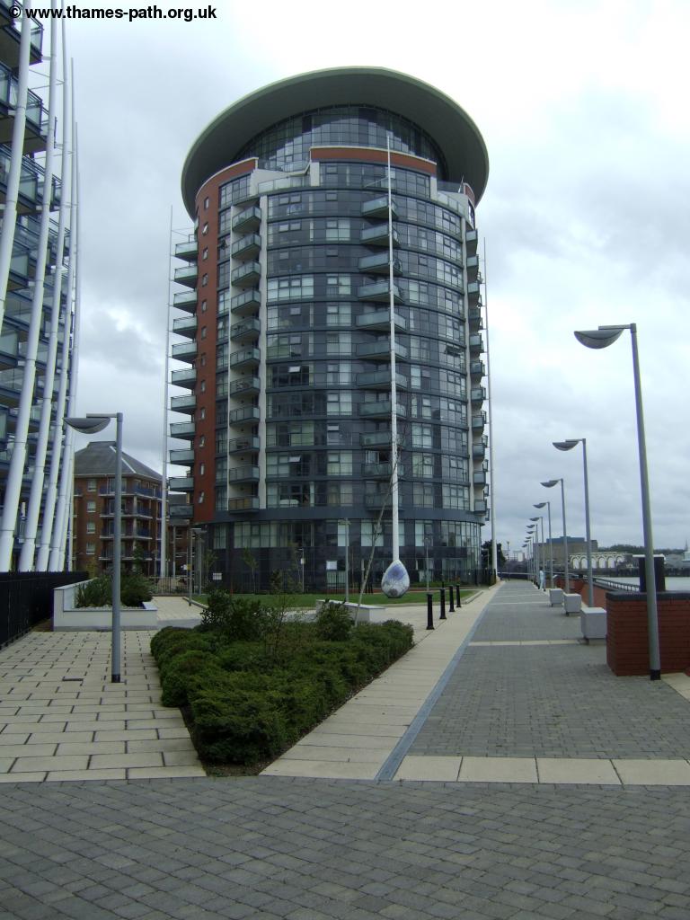
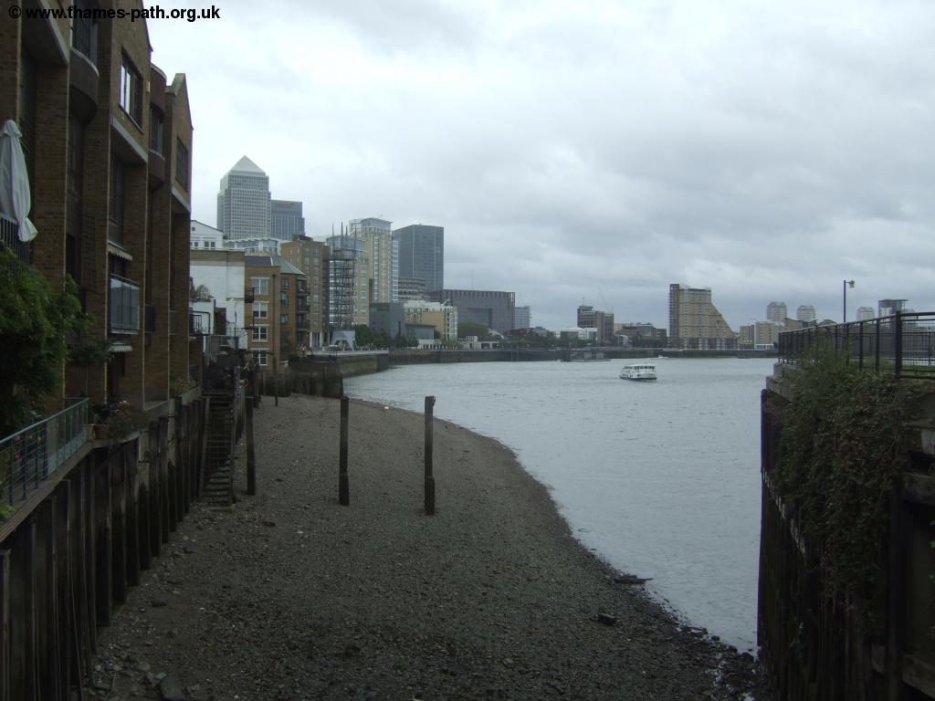
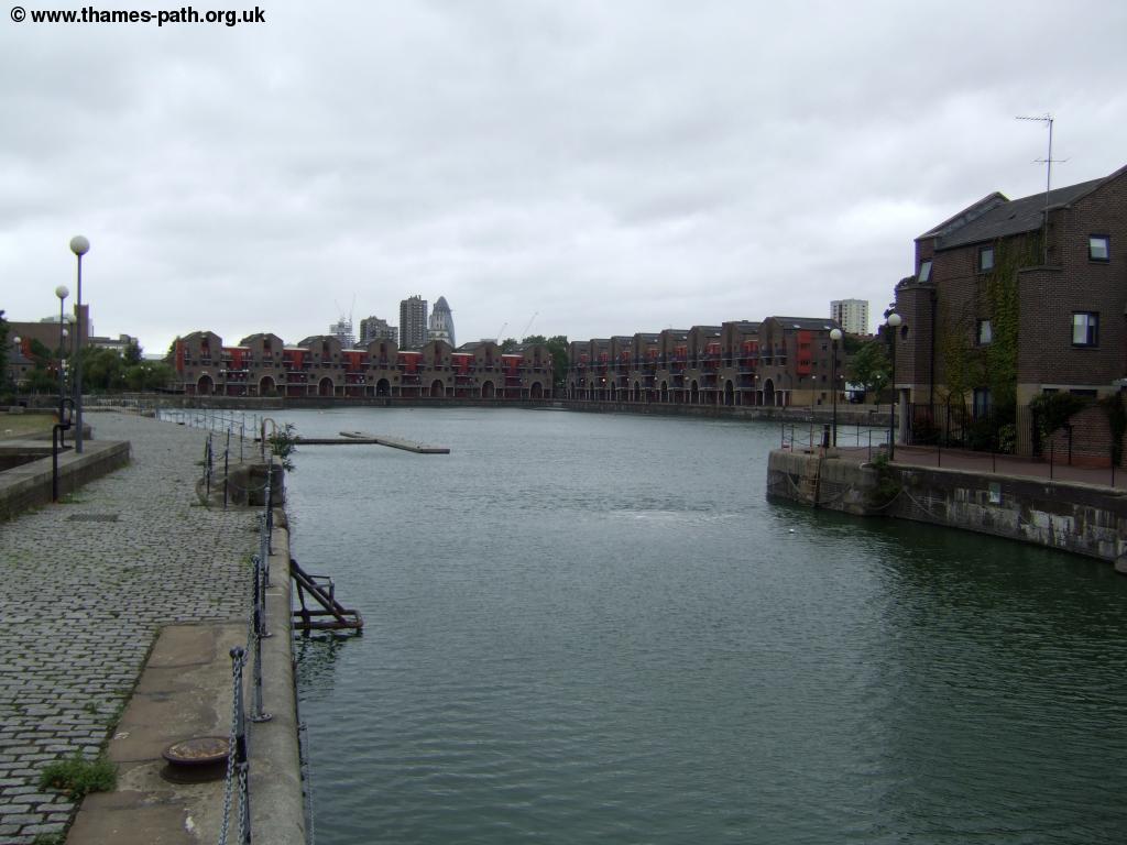
Continuing you soon come to the more modern riverside promenade around the Docklands complex. When the docks that were once a part of this area closed in the 80s the area became derelict and run-down before being re-developed with these impressive tower blocks and other modern buildings, though some of the areas heritage has been retained. It is certainly an impressive area, especially at night when the lights of the many buildings reflect in the water of the old docks. Across the river there is a reminder of what the area was once like, Columbia Wharf.
 |
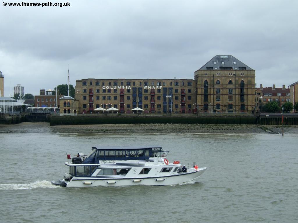 |
| Modern Docklands | Columbia Wharf accross the river |
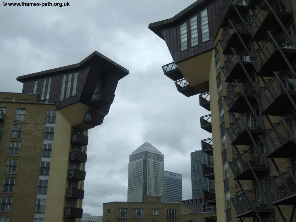
Continue past a block of flats where the balcanoies are on a seperate metal tower, linked to the flats via a bridge on each floor. To the right you can walk into the heart of Docklands itself with numerous stations on the Docklands Light Railway if you want to return home. The riverside path continues over another creek, beneath which runs the Limehouse Link tunnel, removing the traffic from street level here.
 |
| Docklands Creek |
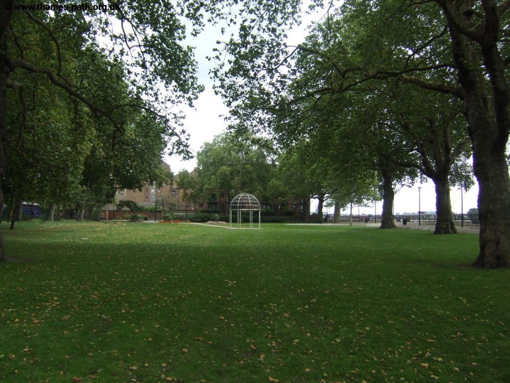
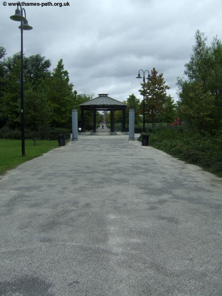
After the creek you come to a park on the right it's large central avenue passing through a band-stand. Beyond the park you pass more modern apartments, getting good views back to Docklands.
 |
 |
| Park near Docklands | View along the river |
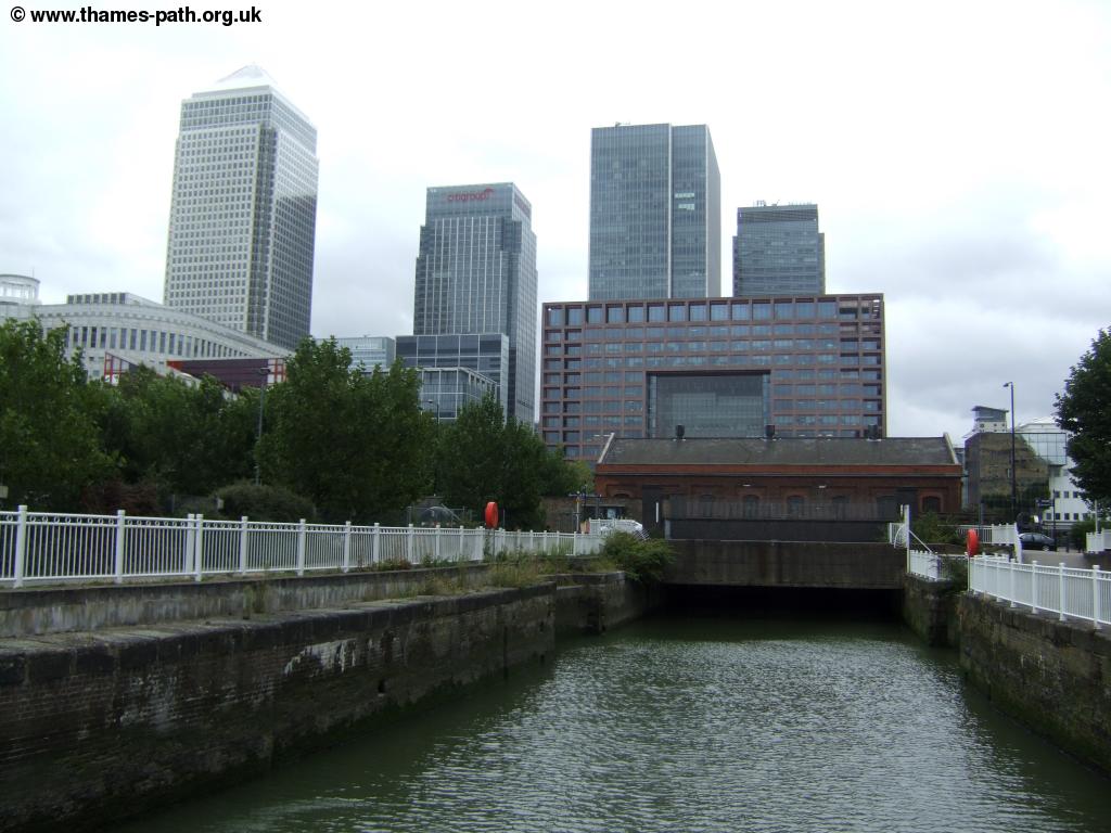
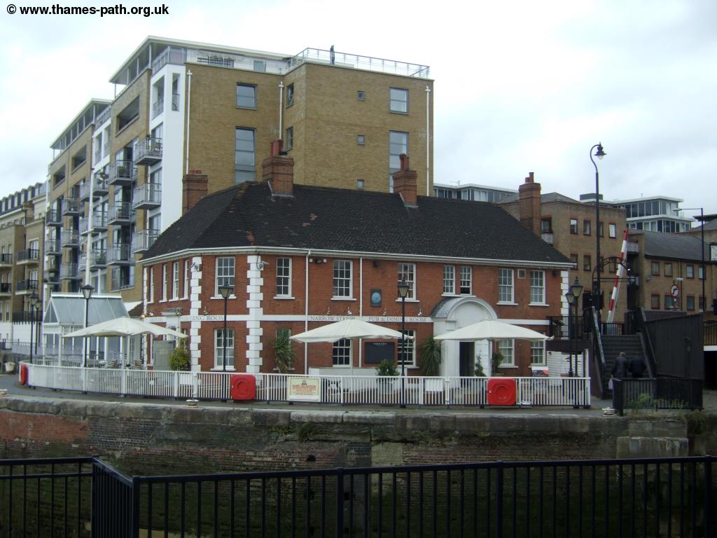
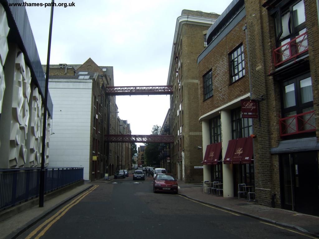
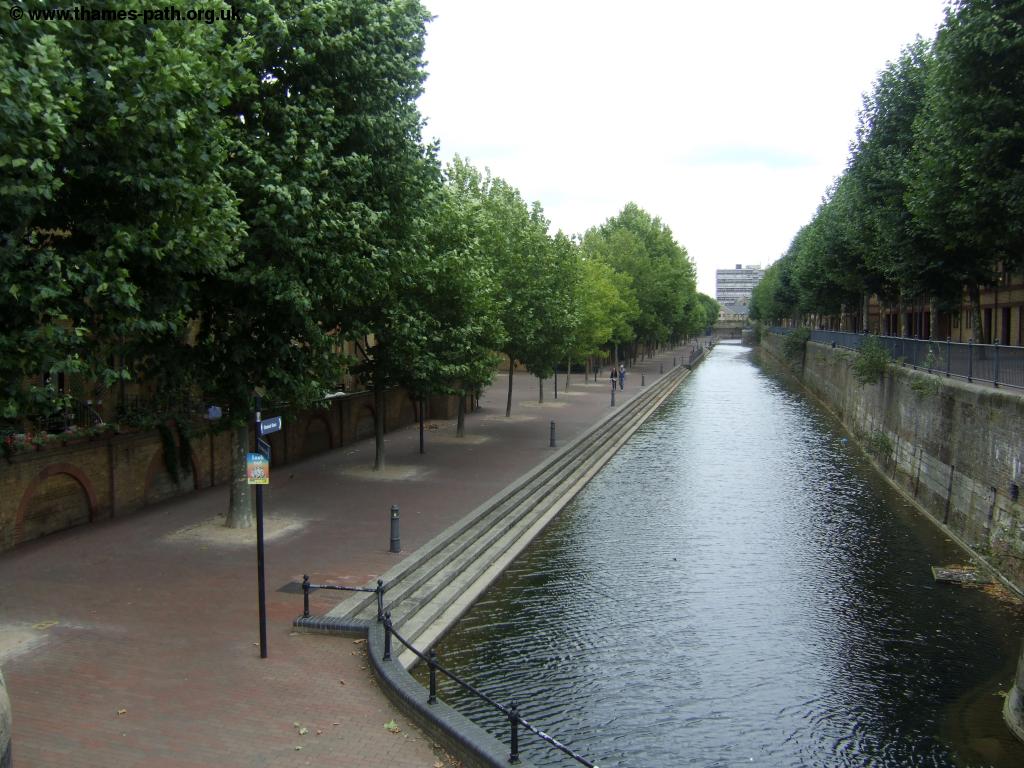
Soon you come to the entrance to Limehouse Basin (formerly Regents Canal Dock), an impressive dock filled with yachts and more traditional canal boats, as both the Hertford Union Canal and Regents Canal join this dock, the latter providing an interesting walk through north London to Little Venice, near Paddington. Cross the large lock gate into the basin, passing the attractive pub on the opposite side of the road, known as Narrow Street.
 |
 |
| The entrance to Limehouse Basin | Limehouse Basin |
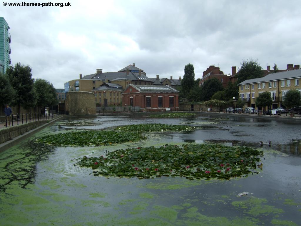
Here you pass two large dock-side buildings obviously now turned into apartments before you get more modern apartments beyond. Continue on this pleasant riverside path until soon you come to the entrance to Shadwell Basin, another old dock although this one was obviously re-developed earlier, as it is surrounded by much lower rise buildings and sadly doesn't seem to be much used by boats these days.
 |
 |
| Shadwell Basin | The Thames near Shadwell Basin |
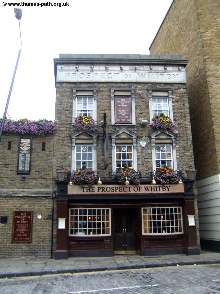
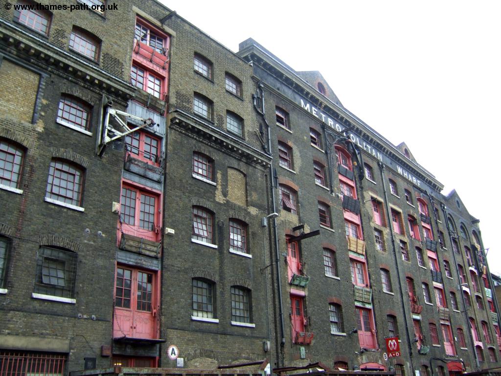
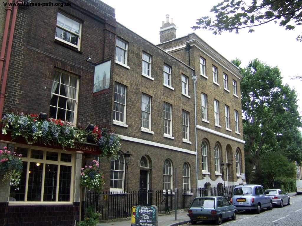
Cross the bridge over the entrance to the basin and from there you stick to this road as you enter Wapping. Wapping is a wonderful part of London, with almost all of the old wharfes have been preserved and converted into housing and offices, with the original cobbled streets remaning. Follow the main road through Wapping passing the tube station and the river police boat yard. You pass the Prospect of Whitby, rumoured to be Londons' oldest pub.
 |
 |
| Wapping | Wapping |
 |
 |
| Wapping | Wapping |
 |
 |
| Wapping | Wapping |
As you come to much more modern apartments on the left a new river path has been built allowing you to walk by the river again, with views to Bermondsey on the opposite bank where many of the old wharfes also exist.
 |
 |
| Wapping | Wapping |
Soon the modern path goes through a small park and rejoins the cobbled High Street. Here to the right are some modern flats round a small pond and beyond you can see the Ornamental Canal heading east.
 |
| The Ornamental Canal,Wapping |
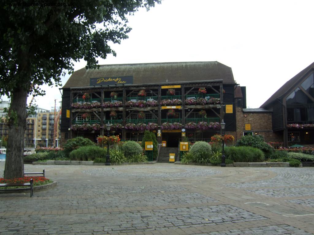
Here you briefly get some more wharfes on the left (where there is a small section of river side path on a jetty) before coming out to St Katherines Dock. This is a really beautiful area, particularly on a summers day, with the many yachts (and sometimes canal boats) moored around the interesting mix of old and new buildings, this is a lovely spot. Here you can follow a path beside the river or walk along the quiet road.
 |
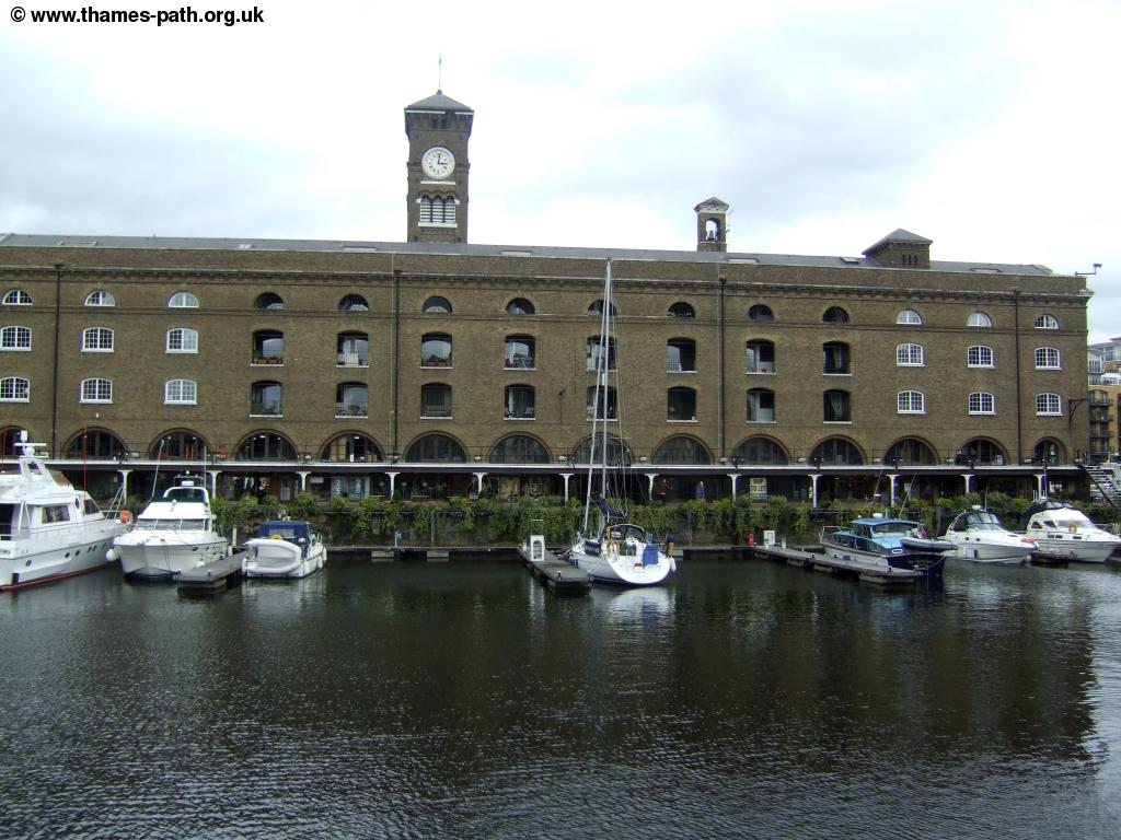 |
| St Katherine's Dock | St Katherine's Dock |
As you cross a wooden bridge over the entrance to the dock, just before the huge (and ugly) Tower Hotel turn left to rejoin the riverside path beside the river with a view to Tower Bridge ahead and a dolphin fountain and compass on the riverside. Until the QE2 Bridge was opened between Dartford in Kent and Thurrock in Essex this was the most easterly road crossing of the Thames. Other than that the only way across was via ferry or a foot tunnel (at Greenwich and Woolwich).
 |
 |
| Tower Bridge | The Thames near Tower Bridge |
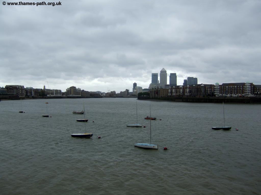
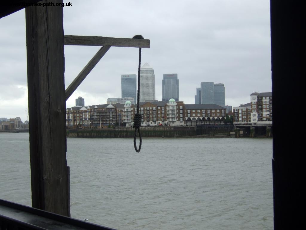
Pass under the arch of Tower Bridge and the cobbles begin once again as the path passes the Tower of London on the right another beautiful part of London. Continue past the tower as the path curves right with the shop on your left. Here turn left and then go right through the gap in the wall to take the riverside path past a white building that has been boarded up and derelict for years (suprising considering how much land is worth around here!). Continue past the Tate and Lyle building with a new (but private) wooden jetty and on past the custom house where the riverside path is sometimes closed (in which case follow the marked diversion along the road instead). Soon you come to the old Billingsgate Market a lovely old building now mostly used for special events and next to it the unusual blue glass building. Soon you come to a narrow wodden bridge as you pass under London Bridge, a more modern bridge. Here you go past some more office buildings including one that is currently being demolished, to come to Cannon Street railway bridge. The old towers of the station remain, but the overall roof was damaged so badly during the second World War it was not repaired and replaced with the modern office building built above the platforms. Pass under the bridge through the dark passage, that seems to be used as an unofficial car park to continue on beside the river. On the other side of the bridge you come to about the only working wharf on this walk, and it is perhaps surprising that is right in the centre of London. Here rubbish is loaded up onto huge barges and transported east along the Thames. At times the path can be closed by a barrier, which has a timer coutning down when the path will re-open.
 |
| Working wharf next to Cannon Street station |
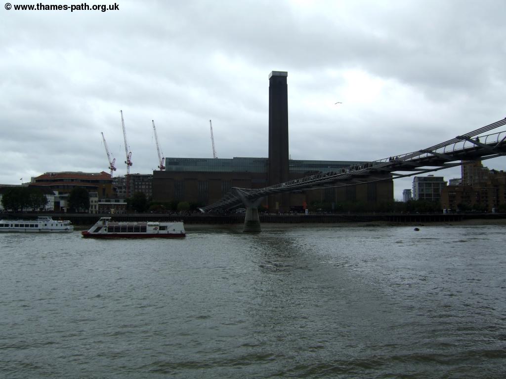
Continue on past some modern office buildings and take the path under one of these to go under Southwark Bridge. Just after the bridge you briefly have to turn right and pass under the entrance to a large office building next to the busy road. Turn left just before the road goes into a small tunnel to rejoin the river as you approach the Millenium Bridge, with fine views of St Pauls Cathedral up the stairs to your left and the Tate Modern (in the former Bankside Power Station) on the opposite bank of the river. It's a nice diversion to walk across the bridge, as it offers fine views of the Thames in both directions, without the disturbance of traffic or trains.
 |
 |
| The Millenium Bridge and Tate Modern | Path towards Blackfriars Bridge |
Continuing on the north bank of the river you soon come towards Blackfriars Bridge where the main road now runs alongside, having been hidden the other side of the buildings until now. The path goes underneath the two adjacent bridges at Blackfriars (the first carrying the trains, the second the road, with the remains of an old railway bridge between).
 |
 |
| Old building by Blackfriars Bridge | Boat along the Embankment |
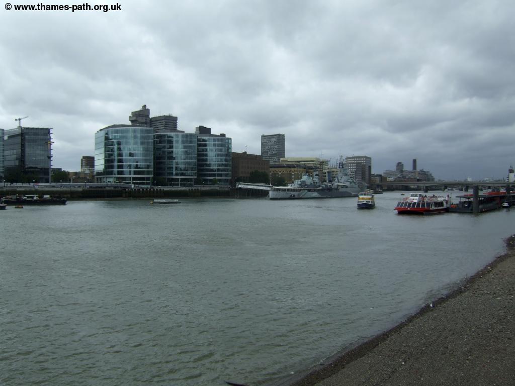
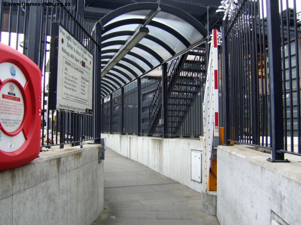
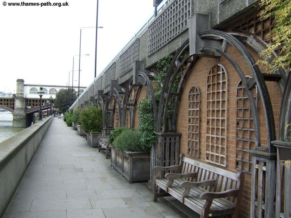
Now you're following the Embankment with it's busy traffic, but the pavement is wide and tree-lined and offers lovely views of the Thames with the London Eye and Oxo tower visible to the left. The river now curves left towards Waterloo Bridge and there are several boats now turned into resturants on the left. Pass under Waterloo Bridge and ahead you can see the new footbridge adjacent to the Hungerford Railway bridge. Continue to this bridge where the walk ends, opposite the London Eye and next to Embankment station.
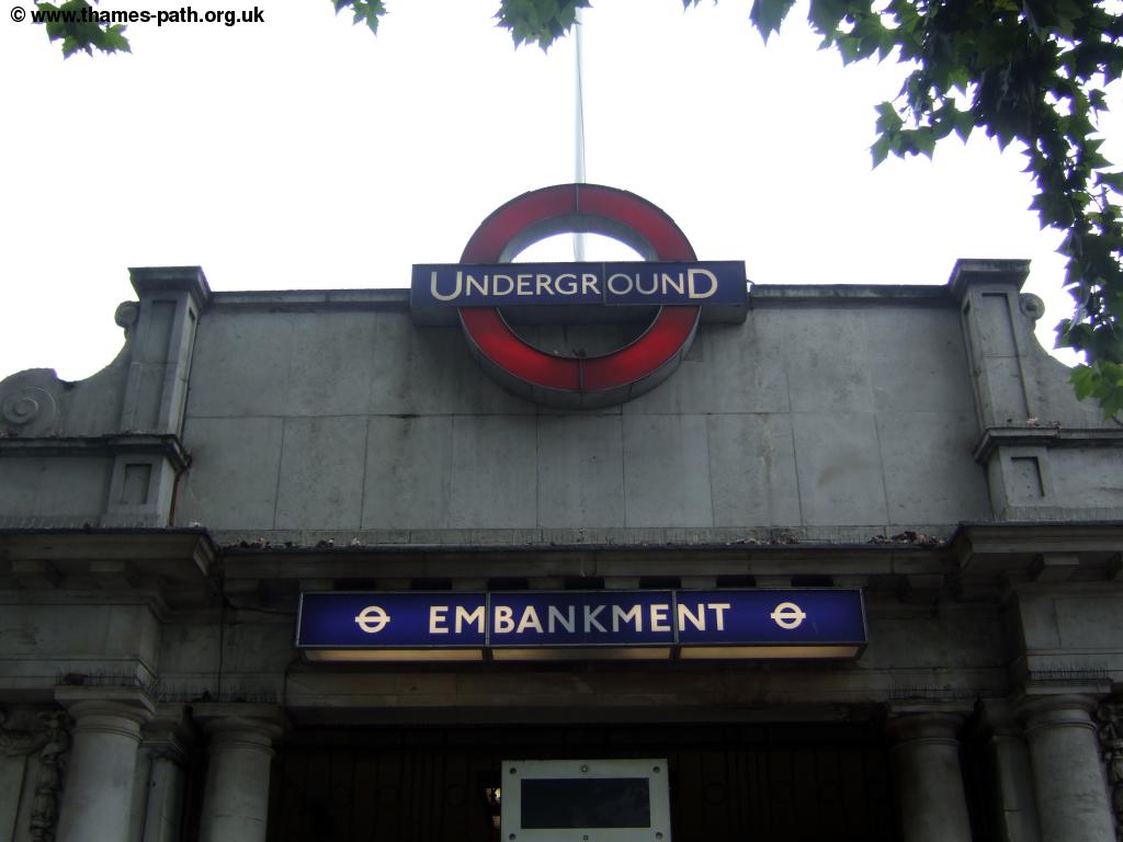 |
| Embankment Station |
Getting Back
If you are returning to Island Gardens take the District or Circle underground line from Embankment station to Tower Hill. From here follow the signs to walk to Tower Gateway DLR station and take the DLR to Island Gardens. You will probably need to change at Limehouse, as from Tower Gateway the trains normally go to Beckton. The walk also finishes next to Charing Cross main-line station from where South Eastern Trains run frequent trains to South and South-East London, Kent and East Sussex. From here there is also access to the Bakerloo and Northern underground lines. If you walk across the new bridge beside the railway line you come to Waterloo station where over ground trains operated to South and South West London, Surrey, Berkshire, Hampshire, Wiltshire, Dorset, Somerset and Devon, operated by South West Trains and there is also a connection with the Jubilee underground line at Waterloo.
Links
The following web sites provide information on the area.
Every effort is made to ensure the accuracy of information on this site, but liability will not be assumed in the event of any inaccuracies. Use of the information on this site is at your own risk. If you find any errors, please use the link below. The text and photographs on this web site are all Copyright © and may not be reproduced without prior permission